World Geography: Module 1
Grade Level: Kindergarten
Core Knowledge Instructions:
"In Kindergarten, children often study aspects of the world around them: the family, the school, the community, etc. The following guidelines are meant to broaden and complement that focus. The goal of studying selected topics in World History in kindergarten is to foster curiosity and the beginnings of understanding about the larger world outside the child's locality, and about varied civilizations and ways of life. This can be done through a variety of means; story, drama, art, music, discussion, and more.
The study of geography embraces many topics throughout the Core Knowledge Sequence, including topics in history and science. Geographic knowledge embraces a spatial sense of the world, an awareness of the physical processes that shape life, a sense of the interactions between humans and their environment, an understanding of the relations between place and culture, and an awareness of the characteristics of specific regions and cultures."
1: ABSTRACT: Foster student's geographical awareness through regular work with maps and globes. Have students regularly locate themselves on maps and globes in relation to places they are studying. Children should make and use a simple map of a locality (such as classroom, home, school grounds, "treasure hunt."
II: OVERVIEW
- Concept Objectives: Students will learn what maps and globes are and what they are used for. Students will gain a beginning geographic vocabulary and a basic sense of how we organize and talk about the world by giving names to some of the biggest pieces of land, and introduce students to the seven continents
- Content from Core Knowledge Sequence: Students will work with maps and globes, recognize how rivers, lakes, and mountains are represented, locate the Atlantic and Pacific Oceans and the North and South Poles.
III: BACKGROUND KNOWLEDGE
- For Teachers: Location of continents
- For Students: nothing
IV: RESOURCES: Globe, state map, city map
 V: ACTIVITIES/LESSONS V: ACTIVITIES/LESSONS
A. Activity One: What is a map and why we use them?
- Objective of Activity: to show students several types of maps and the features they reveal
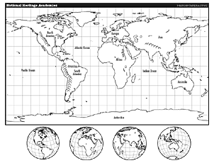
- Activity Content: topographic world map
- Concept of the Activity: Maps depict geographic information and are used for many purposes
- Skill Objectives
- Students will understand what a map is and how it is used
- Key Vocabulary: Continent, river, mountain, ocean, lake, road, map globe, Asia, Europe, Africa, North America, South America, Antarctica, Australia
- Background Notes: This should activity should be fun and should engage the learner in creative thinking
- Procedures:
- Question: What is a map, what are maps used for, how have you seen your parents use a map, who else uses maps, what do they use them for, when could a map save someone life, etc.?
- Show students map (Interactive 1) to be projected to entire class. Simply click on this link to view. When you use your mouse to click on a word, the word will be read aloud to the class. Make sure the volume is turned up on the computer if you want the class to experience this feature. Attachment 1 is a multi-page PDF file of the same map and includes continents to be cut out and used as puzzle pieces.
- Point out the continents and geographic features contained in the vocabulary list. Explain what each is, repeating the word and re-describing it several times.
- Point to a feature and ask the students to tell you in unison what it is.
- Now show the class your drawing of the cafeteria or library which you have already prepared on the blackboard or on a very large board. Discuss what your map depicts and make sure each student understands what is depicted.
- Pass out a blank sheet of paper to your students and ask them to draw a map of their classroom or their playground. Remind them to include doorways or sidewalks.
- Materials:
|

